
Background
The Healesville Freeway Reserve (HFR) consists of 35 hectares of undeveloped land that runs for 3.5 kilometres from Springvale Road in Forest Hill to Boronia Road in Vermont – see map below.
Following strong community interest in keeping the land as public open space the government has committed to retain the land in public ownership for its future use as parkland.
The recently published Concept Plan for the Reserve includes a shared path along the entire length of the Reserve.

Parks Victoria update December 2025
Parks Victoria is reaching out to provide a response to your query regarding an update on the eastern & western connections at ngarrak nakorang wilam (nnw) Park in Vermont / Forest Hill.
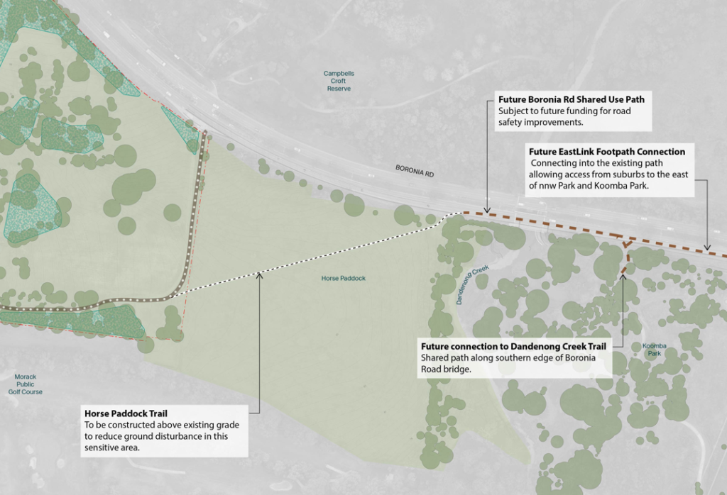
Eastern connection of the nnw Park to the EastLink Trail via Boronia Road
- The former horse paddock at 182-190 Boronia Road, Vermont is an Aboriginal place on the Victorian Aboriginal Heritage Register.
- Parks Victoria has recently received approval from the Wurundjeri Woi Wurrung Cultural Heritage Aboriginal Corporation to build a path through the horse paddock.
- This will be achieved by repurposing soil from other areas of the park to ‘build up’ ground levels and avoid disturbance of the existing ground.
- Parks Victoria will construct the pathway through the horse paddock, up to the nnw Park boundary near Dandenong Creek.
- An update to the park layout plan will be published in January 2026 to advise the community of this addition.
- There is a currently an un-formalised access from the end of our works into Koomba Park.
- The future upgraded connection into Koomba Park & the EastLink trail will require the installation of road safety barriers on Boronia Road to create a safe corridor for the shared use path.
- Parks Victoria has completed design investigations for the road safety barriers (including a study of the Boronia Rd bridge over Dandenong Creek), however additional funding is required to deliver these works.
- Costings have been shared with the Member for Glen Waverley to enable future funding opportunities.
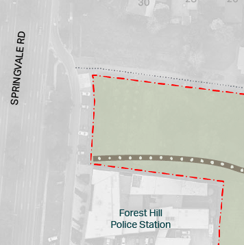
Western section near Springvale Road
The design and construction of a future signalised crossing of Springvale Road is the responsibility of Whitehorse City Council and the Department of Transport and Planning. These works will require future funding.
The western section of the path will terminate at the parkland boundary, connecting into the Springvale Rd service lane (Saxonwood Drive).
Whitehorse City Council is responsible western section of the park (including Davy Lane Reserve & Strathdon House) as committee of management for the Crown Land.
Update November 2025
MeBUG member David Simm reports recent progress as follows.
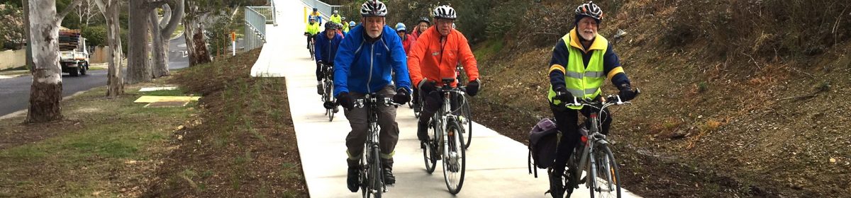
There is good news for all those WCI members who, commencing in 2010, advocated tirelessly for construction of a path from Springvale Rd, Forest Hill to Boronia Rd, Vermont South on the VicRoads Healesville Freeway Reserve. After all that letterboxing, petition signature collecting, the Open Day and the interminable stakeholder meetings with the various bureaucracies construction has started and is well on the way!
The Reserve is now a state park under the control of Parks Victoria and renamed Ngarrack Nakorang Wilum Park.
The new trail is being built in sections with the first section from Morack Rd east to Boronia Rd virtually finished except for the installation of play equipment.
The second section from Davy Lane is also well on the way.
Advocacy is continuing for an Eastern link from the trail’s end at Boronia Rd to the nearby Dandenong Creek paths and at the Forest Hill, Western, end to the Melbourne Water Pipe Track.
So we are not there yet but a final push will result in a major benefit.
Update August 2025
Work will start soon on a new trail and parklands through Melbourne’s outer east on the site of the former Healesville freeway reservation.
The 3.5-kilometre trail will run east-west through from Forest Hill, through Vermont and connecting to the Dandenong Creek Trail and through Eastlink Trail. See Bicycle Network project update
Update November 2022
MeBUG has submitted a response to Parks Victoria, on the 2022 Concept Plan and Draft Map. Read our response.
Update October 2022
MeBUG has been an active member of the Community Reference Group and is advocating for a high quality path through the Reserve. We are also urging government to ensure the Eastern end of the path connects to the Dandenong Creek Trail. To this end, we ask that you support our Change.org petition.
Parks Victoria has now released its draft Park Layout Plan.
Update June 2022
The Healesville Freeway Reserve trail is to be completed in 2024. It will traverse the 3.5 kms of former Reserve land that runs east-west between Boronia Road and Springvale Road, south of Hawthorn Road. The east end is right by the Dandenong Creek Trail, and access to the Pipe Track and Hawthorn Road is not far away on the west. It will be a really valuable link as well as a conduit for walkers and cyclists to local schools.
There is, however, only a $9 million budget which may include works other than the cycle path and, of course, there are many people with ideas for various other amenities in the park. The cycle path is a key objective; its precise route and surface is not yet determined. Our goals for the project are:
- That the route is to go East-West through the length of the reserve (connecting the Eastlink/Dandenong Creek Trail to the Syndal to Heatherdale Pipeline Trail) with appropriate connections to side streets, to allow access.
- The route is to avoid steep gradients to make the trail rideable for all ages and abilities.
- The route and construction of the path should minimize disturbance of native vegetation and prevent erosion as much as possible.
- The surface to be used is to be one that avoids using coarse aggregate and minimises the likelihood of punctures and improves the riding in all-weather conditions.
Parks Victoria has invited tenders for the design of the park within the reserve.
MeBUG member David Hall has developed detailed proposals for the route of the path through the reserve and also its potential contribution to Melbourne’s Strategic Cycling Corridors.